|
|
Order by Related
- New Release
- Rate
Results in Title For gps
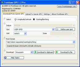 | GPS Software for Garmin. Download waypoints, routes and tracks from Garmin GPS. Upload waypoints, routes and tracks to Garmin GPS. Excel and Text files supported! This software is very easy to use! .. |
|
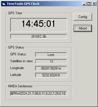 | GPS Clock Software is a freeware utility that runs on any Windows NT/2000/XP/2003 workstation or server. The software polls time from a standard NMEA GPS time receiver connected to the host PC's serial port and optionally allows time to be synchronised on the host PC. The GPS clock utility polls GPRMC messages from a standard NMEA GPS time receiver. Information received from the GPS receiver such as time, date, gps status, satellites is shown. The GPS clock utility can also update the system time of the host PC with GPS time. Note however, time synchronisation can only be acheived to the nearest second. Standard NMEA GPS devices do not have a pulse per second output that can be utilised by the serial port of a PC. Therefore, the microsecond accuracy that is available from TimeTools GPS T1000 and T2000 GPS timing receivers is not available with this software. ..
|
|
 | GPS Express provides a feature rich interface to serial NMEA-0183 protocol data and works with most NMEA-0183 devices, including GPS Receivers. GPS Express is available in three versions (Standard, Professional, Graphical)... .. |
|
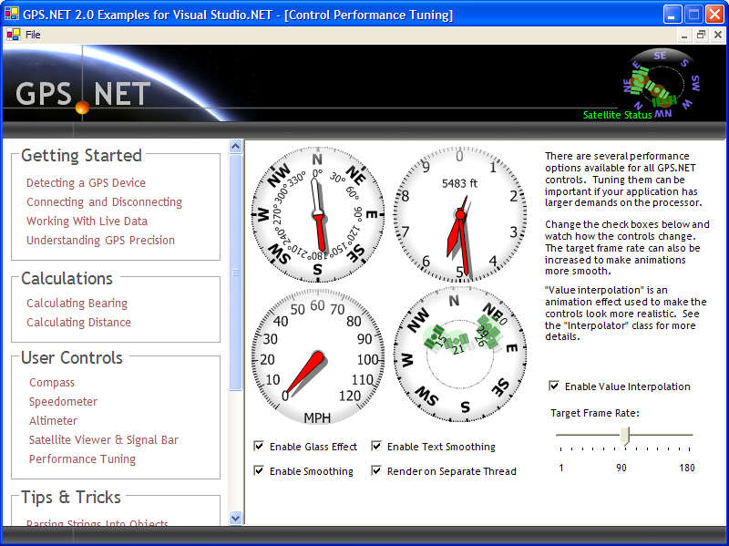 | Develop precise, efficient, and reliable GPS software in record time with this multithreaded component for desktop and mobile devices, including PocketPC, Windows CE, Tablet PC, Smartphone and Windows Mobile! ..
|
|
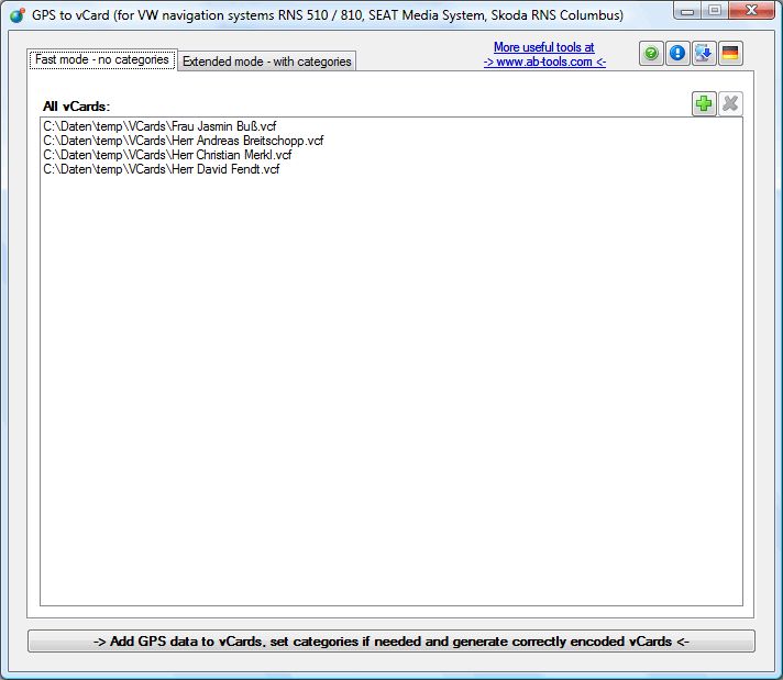 | With this tool you can add GPS coordinates to vCards - elektronic business cards. Therefore the tool uses the address data contained within the vCards and adds the exact GPS position on that basis to the vCard. .. |
|
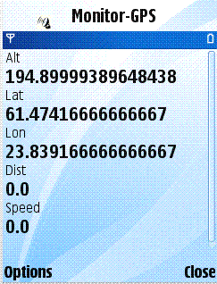 | Monitor-GPS is a service for tracking the family and friends using their phones.Install monitor-gps your phone and family and friends will be able to find you through http://monitor-gps.com website or with the Monitor-GPSFleet mobile application. ..
|
|
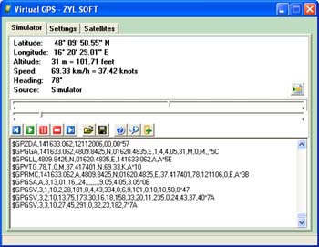 | GPS simulator software. You can use it to simulate a GPS receiver unit connected to your system. It`s ideal when you need GPS input, but you have no signal or for development purposes. .. |
|
 | The Tro GPS Simulator provides a complete suite for all your GPS simulating needs and more. The Tro GPS Simulator uses the international standardized protocol NMEA-0183 for GPS data exchange. It can simulataneously send and recieve data.Furthermore it provides several input methods for GPS data:(1) Manual Input(2) Log files Playback(3)Forwarded Input(4)Default sentence selection and simulation To provide as much flexibility as possible the user can choose one of the four inputs options to specify where the simulated positioning data comes from. With the Manual Input method it is possible to enter an exact position that will be sent to the output Interface. User can send data from any text file or previously logged data in Log file Playback. The Forwarded Input method works like a multiplexer where the user can connect to a GPS receiver over a serial port. The data from this GPS receiver will be sending unchanged over the output interfaces. User can select sentences for simulation for configurable baud rate and loop back rate in Default sentence selection and simulation. Current release includes features:(a)Single application wraps everything!(b) No third party tool required!(c)International Standardized Protocol NMEA-0183 support!(d)Supporting simulation of GPS receiver/sender Serial Port RS-232!(e)Two COM Ports can be configured for I/O to receive/send GPS Information!(f)Supports 2 modes for GPS Simulation!(g)All COM Ports sending/receiving can be viewed simultaneously!(h)Default NMEA-0183 sentences selection and simulation!(i)Provide modification mechanism for NMEA-0183 values!(j)Structured display mechanism for NMEA-0183 values!(k)Log files Playback!(l)Easy transmission of GPS Data over Network!Please for more info click on http://www.trosys.com/htmpages/gpssimulator.htm .. |
|
 | Play a Fun Hiking GPS Puzzle. .. |
|
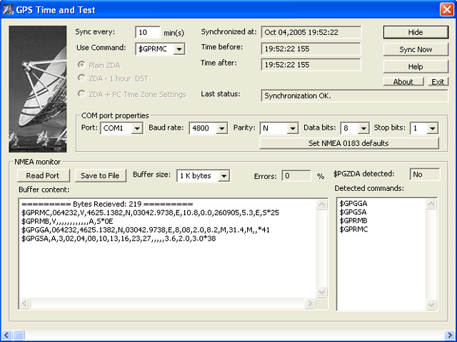 | PC Clock synchronization using GPS. It can be used as NMEA and COM port tester. The program synchronizes a PC Clock to the right time using artificial satellites. .. |
|
Results in Description For gps
 | Black Friday, or the day after Thanksgiving, is a great time to shop for GPS units. Last year, we were right in the middle of a big change - Black Friday meant GPS deals on the front covers of a several circulars. I was out at 5AM grabbing a GPS unit.. |
|
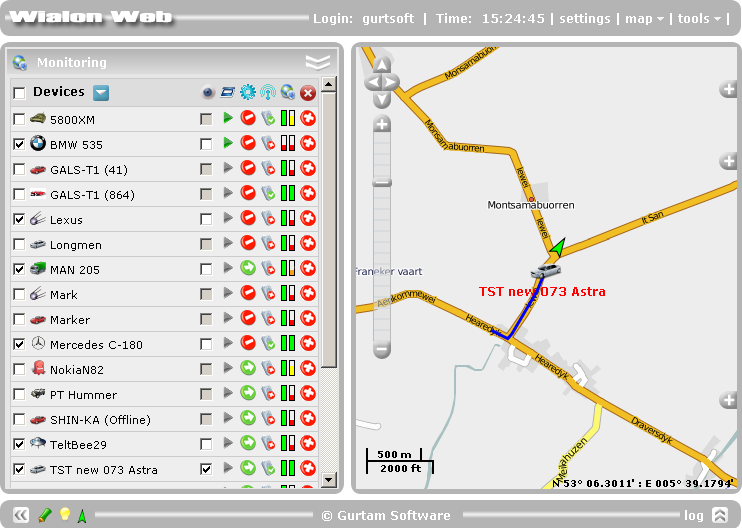 | Wialon GPS Tracking is a leading professional software for GPS vehicle tracking to assist fleet management. In order to see how Wialon GPS Tracking System works please download its Demo Version...
|
|
 | Improve your golf game with a handheld GPS that gives distance to pin, club suggestions, locations of hazards and much more. Wherever in the world you play golf, the sureshotgps will allow you to obtain distances from tee to green. Experience the difference with better club selection, speedier play and statistical information per round of golf. The sureshotgps relies on GPS satellite signals to determine your position, then using the course data stored in its memory, calculates the distances to the green and any hazards. These GPS satellite signals are available free of charge. There is no subscription required to use these signals. With the use of GPS, sureshotgps can determine the distance to objects that are not in your line of sight. GPS can provide you with distances anywhere on the course that may be difficult to get with laser based range finders or course yardage books. Many golf courses already have GPS devices installed in their golf carts, sureshotgps is a handheld GPS device that can be taken by the player to any course. The R&A and USGA have recently announced the changing of GPS usage during competition play... |
|
 | GPS Express provides a feature rich interface to serial NMEA-0183 protocol data and works with most NMEA-0183 devices, including GPS Receivers. GPS Express is available in three versions (Standard, Professional, Graphical).....
|
|
 | Monitor-GPS is a service for tracking the family and friends using their phones.Install monitor-gps your phone and family and friends will be able to find you through http://monitor-gps.com website or with the Monitor-GPSFleet mobile application... |
|
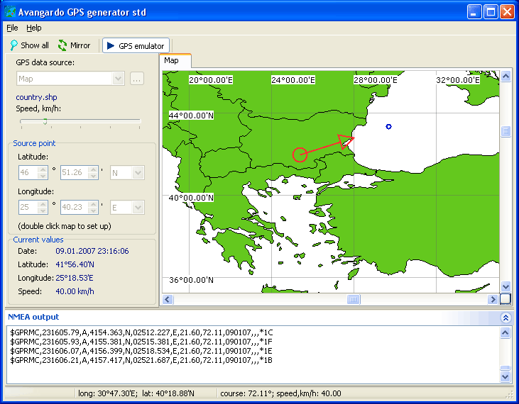 | Software GPS device emulator. Generates NMEA messages from different data inputs. 1)User can select map,start point,heading,speed;2)User can select NMEA log file. Generator write NMEA sentences to COM port or file. Use GPS without GPS receiver...
|
|
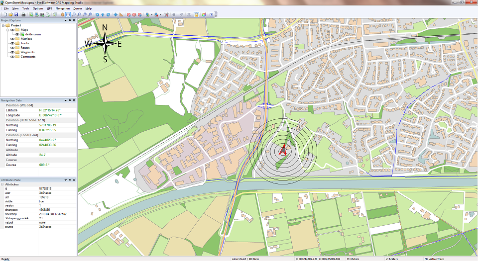 | GPS Mapping Software for Windows, Loading topographic maps, Realtime navigation, GPS position tracking, Map import and export, Coordinate conversion and more.. |
|
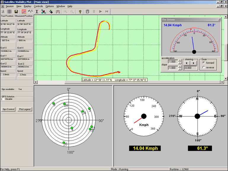 | Accord's GPSLAB is a PC based GPS software simulator which can simulate GPS satellite constellations and GPS receiver sensor. GPSLAB supports simulation of user's vehicle motion in real time and models the behavior of a GPS receiver. Based on the position of the simulated coordinates, GPSLAB computes the satellite constellation and range information.
GPSLAB facilitates the user to configure error characteristics and behavioral idiosyncrasies of the individual error sources that effect GPS measurements and study the effects on the outputs under various conditions of vehicle dynamics. Simulated user dynamics are displayed on the screen, stored in files and also transmitted on the serial port in real time.
GPSLAB can be a very powerful tool for software development, testing, evaluation and system integration. It can serve as a valuable aid in the performance analysis of GPS sensors... |
|
 | GPS Software for Garmin. Download waypoints, routes and tracks from Garmin GPS. Upload waypoints, routes and tracks to Garmin GPS. Excel and Text files supported! This software is very easy to use!.. |
|
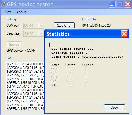 | GPSdevTest is the Windows application designed as the GPS device diagnostic tool. Main features: COM port (native, mapped USB or Bluetooth ) auto detection for attached device; GPS data logging, statistics, display, etc... |
|
Results in Tags For gps
 | Develop precise, efficient, and reliable GPS software in record time with this multithreaded component for desktop and mobile devices, including PocketPC, Windows CE, Tablet PC, Smartphone and Windows Mobile!.. |
|
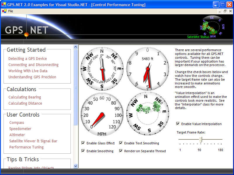 | Develop precise, efficient, and reliable location-based services with this multithreaded framework for desktop and mobile devices, including PocketPC, Tablet PC and now Smartphone! Over fifty classes in one lightweight assembly gives you unparalleled features while saving you hundreds of dollars in development and testing.
GPS.NET is loaded with features, including:
NEW: now supports .NET Compact Framework 2.0!
NEW: now supports Smartphone!
Works with PocketPC, Tablet PC and desktop platforms.
Automatically discovers GPS devices.
Automatically detects GPS protocols (NMEA / Garmin binary).
Automatically recovers if Bluetooth devices go out of range
Converts coordinates from latitude/longitude <--> UTM.
Calculate distance, bearing, intersection, and positions within range.
UTM calculations work across UTM zones!
Real-time GPS satellite viewer user control
Dynamic Help and IntelliSense for Visual Studio.NET
Windows Mobile™ certified
Unlimited, royalty-free license!
Download a free 30-day trial now and see just how fast GPS.NET can get your location-based software to market!..
|
|
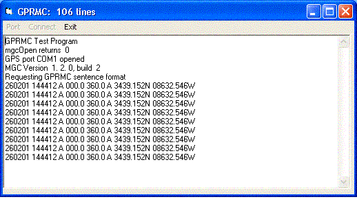 | Win/CE GPS client library component reads and decodes standard GPS NMEA 183 sentences from the RS232 serial port as well as compute great circle distances and bearings. Registration is $105 ($195 with source) for email delivery... |
|
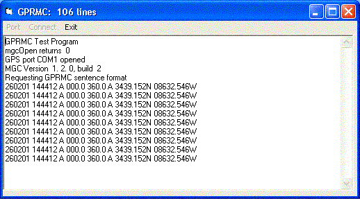 | MarshallSoft GPS Component C/C++ (.NET) library toolkit (MGC4C) reads and decodes industry standard GPS NMEA 183 navigation sentences from the RS232 serial port as well as computes great circle distances and bearings.
Features of MGC4C include: The most current GPS data is always available on demand * Runs as a background thread unattended * Works with Bluetooth virtual serial ports * Works with USB serial ports (with a USB to serial converter) * The most commonly used NMEA navigation sentence types (GPGGA, GPRMC, GPGLL, GPGSV, and GPVTG) are automatically decoded * Includes C, C++, VC.NET, and C# example programs * Uses the Windows Win32 API for serial port input - no special Windows driver or support libraries are required * Supports Microsoft Visual C/C++ (including .NET), C# .NET, Borland 5.0 and 5.5, Watcom 11.0, and LCC-WIN32 * Can be used with Microsoft Foundation Class MFC and Borland C++ Builder programs * Can also be used with Delphi, Visual Basic, VB.NET, VBA application (EXCEL, ACCESS, WORD, etc), Visual FoxPro, Visual dBase, Xbase++, PowerBasic and COBOL * Can be ordered with or without C source code for the DLL * Free technical support and updates for one year * Includes 3 manuals: Programmers Manual, Reference Manual, and Users Manual (Online and printed). * Runs under Windows 95/98/Me/NT/2000/2003/XP/Vista * Royalty free distribution with your compiled application.
The evaluation version of MGC4C is fully functional and can be downloaded from http://www.marshallsoft.com/mgc4c.htm. The Visual Basic version (which used the same DLL as the C/C++ version) can be downloaded from http://www.marshallsoft.com/mgc4vb.htm. The Win/CE (Pocket PC) version can be downloaded from http://www.marshallsoft.com/mgc4evc.htm...
|
|
 | Toolkit to add GPS and coordinate conversion functionality to software (GPS API). All NMEA0183 protocol versions are supported, Garmin USB PVT support. Support for datum conversions and coordinate conversion using different map projections... |
|
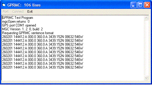 | MarshallSoft GPS Component VB (and VB.NET) library toolkit (MGC4VB) reads and decodes industry standard GPS NMEA 183 sentences from the RS232 serial port as well as computing great circle distances and bearings.
Features of MGC4VB include: The most current GPS data is always available on demand * Runs as a background thread unattended * Works with Bluetooth virtual serial ports * Works with USB serial ports (with a USB to serial converter) * The most commonly used NMEA navigation sentence types (GPGGA, GPRMC, GPGLL, GPGSV, and GPVTG) are automatically decoded * Includes Visual Basic and VB.NET example programs * Can be used with VBA application (32-bit EXCEL, ACCESS, WORD, etc.) * Uses the Windows Win32 API for serial port input - no special Windows driver or support libraries are required * Can also be used with C, C++, C#, Delphi, Visual FoxPro, Visual dBase, Xbase++, PowerBasic and COBOL * Can be ordered with or without C source code for the DLL * Free technical support and updates for one year * Includes 3 manuals: Programmers Manual, Reference Manual, and Users Manual (Online and printed). * Runs under Windows 95/98/Me/NT/2000/2003/XP/Vista * Royalty free distribution with your compiled application.
The evaluation version of MGC4VB is fully functional and can be downloaded from http://www.marshallsoft.com/mgc4vb.htm. The C/C++/C# version (which used the same DLL as the C/C++ version) can be downloaded from http://www.marshallsoft.com/mgc4c.htm. The Win/CE (Pocket PC) version can be downloaded from http://www.marshallsoft.com/mgc4evc.htm...
|
|
 | Take your GPS applications to the next level with this high-performance plug-in for GPS.NET! These crisp, accurate user controls make your GPS application easy to read. Add a compass, altimeter, real-time GPS satellite tracker, signal bar and speedometer, or even create your own control! Controls are developed using our multi-threaded double-buffered control framework, making it easy to develop controls and port them to any .NET platform!
The GPS.NET User Controls Plug-In includes all of the following features:
Automatically displays real-time GPS data from any available GPS device!
Highly-optimized double-buffered architecture delivers extremely fast rendering speed.
Includes animation and interpolation features to create smooth, realistic animations!
Includes open control development framework for creating your own user controls!
Available for Visual Studio.NET 2002, 2003 and now 2005!
Fully supports PocketPC 2002, 2003 and 2003 Second Edition
Fully supports Smartphone
Fully supports Windows Mobile 5.0
Clearly-written integrated Dynamic Help and IntelliSense for Visual Studio.NET
Windows Mobile™ certified
Unlimited, royalty-free license!
Download a free 30-day trial now and see just how fast GPS.NET User Controls can help you get your location-based software to market!.. |
|
 | Improve your golf game with a handheld GPS that gives distance to pin, club suggestions, locations of hazards and much more. Wherever in the world you play golf, the sureshotgps will allow you to obtain distances from tee to green. Experience the difference with better club selection, speedier play and statistical information per round of golf. The sureshotgps relies on GPS satellite signals to determine your position, then using the course data stored in its memory, calculates the distances to the green and any hazards. These GPS satellite signals are available free of charge. There is no subscription required to use these signals. With the use of GPS, sureshotgps can determine the distance to objects that are not in your line of sight. GPS can provide you with distances anywhere on the course that may be difficult to get with laser based range finders or course yardage books. Many golf courses already have GPS devices installed in their golf carts, sureshotgps is a handheld GPS device that can be taken by the player to any course. The R&A and USGA have recently announced the changing of GPS usage during competition play... |
|
 | GPS Express provides a feature rich interface to serial NMEA-0183 protocol data and works with most NMEA-0183 devices, including GPS Receivers. GPS Express is available in three versions (Standard, Professional, Graphical)..... |
|
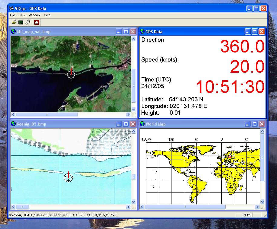 | - you can show a currentl GPS data; - you can open any of scanned maps; - you can calibrate the scanned maps yourself by two calibration points only; - calibrations are stored automatically for every map;.. |
|
Related search : ps net,net global positioninggps componentmarshallsoft gps,www marshallsoftmarshallsoft comhttp wwwdownloaded fromgps componentmarshallsoft gps,downloaded from httpmap grid,www marshallsoftmarshallsoft comhttp wwwdownloaded fromgps componentvisual baOrder by Related
- New Release
- Rate
timex gps -
java gps -
gps track -
gps pda -
gps earth -
|
|


